

 1
destination
1
destination
destination
Ledges Trail
What people say
Ledges Trail is a rocky 1.8-mile loop around towering sandstone formations, with connector options, historic stonework and a west-facing overlook near the trailhead playfield. Download or photograph the trail map before starting because connectors make the loop easy to misread. Rock climbing is prohibited, Ice Box Cave remains closed for bat protection and wet or icy stone can be extremely slippery.
At this place
Upcoming events
Inside this place
Explore the grounds
Choose a destination, preview what it looks like, then open Explorer for live on-site guidance.
1
destination
 2
destination
2
destination
Beaver Marsh
Beaver Marsh is a wildlife-rich wetland crossed by the Towpath Trail boardwalk, reached by an accessible quarter-mile walk north from Ira Trailhead.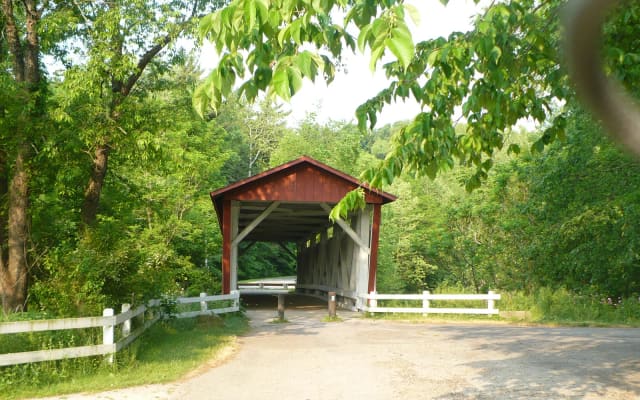 3
destination
3
destination
Everett Covered Bridge
Everett Covered Bridge is Summit County's only remaining covered bridge, reached by a short firm trail from a developed Everett Road trailhead with accessible restrooms.Public record
Verified information
What people ask
Useful answers about this place
10 answers
Frequently requested details, researched and kept current by AuditMap.
Where exactly is Ledges Trail?
Start at Ledges Trailhead on Truxell Road and read the map at the bulletin board before entering the loop. The trail network has multiple connectors; the overlook can also be approached across the playfield for a shorter visit.
Where should I park for Ledges Trail?
The official lot has 233 spaces, including eight accessible spaces, and serves the trail, shelter, playfield and restrooms. Use the mapped lot rather than a broad national-park pin.
When is Ledges Trail open?
The Ledges area closes at dusk. Snow, ice, storms and resource closures can make the rocky route unsafe before the normal closing time.
Are there restrooms near Ledges Trail?
Ledges Shelter has year-round flush restrooms. Drinking water is normally available May 1 through September 15, so carry water outside that season.
Is Ledges Trail free?
The trail and parking are free. Reserving Ledges Shelter or holding a permitted event costs separately.
How accessible is Ledges Trail?
The shelter and developed trailhead facilities are accessible, but the complete loop is rocky, unpaved and includes at least 80 feet of elevation change. Use the paved shelter area or check the overlook approach rather than treating the full loop as step-free.
Are dogs allowed at Ledges Trail?
Leashed pets are allowed on the trail with a leash six feet or shorter. Keep pets away from cliff edges, wildlife and other hikers, and carry water.
Is Ledges Trail good for children?
The rocks can feel adventurous for older children, while the nearby playfield and shelter offer easier alternatives. Use sturdy shoes, stay together at junctions and supervise closely at the overlook and uneven stairs.
What should I know before visiting Ledges Trail?
Download or photograph the trail map before starting because connectors make the loop easy to misread. Rock climbing is prohibited, Ice Box Cave remains closed for bat protection and wet or icy stone can be extremely slippery.
How do you reach Ledges Trail?
The park is spread across a large valley. Seasonal railroad and limited regional options exist, but most visitors drive or bicycle between selected stops.
Quick community check
Help verify this place
Know this place? Check one detail from a recent visit.
✓ Accurate × Incorrect ? Unsure
Community for this place
What people are noticing
Ask a question, share what changed, or help make a detail more reliable.
The place logUseful questions, updates, and confirmations from this community.
Keep exploring
Nearby public places
Based on this place's location and public details, not your activity.