
Citywide public trail network
Capital Area Greenway System
What people say
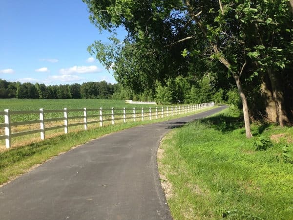
Raleigh's Capital Area Greenway is a citywide network of 28 named trails totaling more than 100 miles, connecting neighborhoods, parks, lakes, downtown, the NC Museum of Art, Umstead State Park, the Neuse River, and adjoining trail systems for walking, cycling, mobility devices, recreation, and transportation.
At this place
Upcoming events
Inside this place
Explore the grounds
Choose a destination, preview what it looks like, then open Explorer for live on-site guidance.
Public record
Verified information
What people ask
Useful answers about this place
Frequently requested details, researched and kept current by AuditMap.
Where should I park for Raleigh's Capital Area Greenway?
There is no single greenway parking lot. Choose an individual trail and trailhead first, then use Raleigh's Greenway Explorer to locate official parking near that route. The Explorer also identifies restrooms, bike repair stations, parks, and other amenities. Never improvise parking in a neighborhood, business, or apartment lot.
Where is the best entrance to the Raleigh greenway system?
The best entrance depends on the trail and destination; the Capital Area Greenway has many trailheads rather than one gateway. Start with a named route such as Neuse River, Walnut Creek, Crabtree Creek, Reedy Creek, or a lake loop, then select a documented trailhead close to the distance and amenities you need.
Are there restrooms along Raleigh greenways?
Some trailheads and connected parks have restrooms, but many trail segments do not. Use the Greenway Explorer to find the nearest documented restroom and check the host park or building hours. A restroom marker does not guarantee it is unlocked after hours, during winterization, or during maintenance.
What hours are Raleigh greenways open?
Capital Area Greenway trails are open from dawn to dusk daily. Connected parks, parking gates, restrooms, museums, and neighboring jurisdictions can follow different schedules. Plan enough time to return to your trailhead before dusk and do not rely on trail lighting for a late return.
Is the Capital Area Greenway free?
Yes. Raleigh's public greenway trails are free to use. Costs may arise for parking at a connected destination, bike or scooter rental, transit, an organized event, or a museum, pool, program, or other facility reached from the trail. Check the destination separately.
Are Raleigh greenways wheelchair accessible?
Many paved segments can support wheelchairs and mobility scooters, and Raleigh presents the network for those users, but the system is not uniformly accessible. Trail grade, pavement condition, curb transitions, bridge approaches, flooding, construction, and natural-surface segments vary. Verify the exact trailhead and segment rather than relying on the system-wide label.
How many miles of greenway trails does Raleigh have?
The City's current public trail list describes 28 trails totaling more than 100 miles. Other planning documents may use larger figures because they count newer construction, connectors, proposed routes, or open-space holdings differently. For trip planning, use the current named-trail list and each route's stated mileage.
Does Raleigh's greenway system go to Charlotte?
No. The Capital Area Greenway is Raleigh's local and regional network and does not provide a continuous trail to Charlotte, about 160 road miles away. Raleigh trails connect with nearby systems and long-distance routes such as the East Coast Greenway and Mountains-to-Sea Trail, but those do not turn the city network into a Raleigh-to-Charlotte greenway.
What is the best map for Raleigh greenways?
Use the mobile-friendly Capital Area Greenway Explorer for nearby trailheads, parking, restrooms, repair stations, dog parks, playgrounds, and parks. It is an amenity-finding tool, not turn-by-turn navigation. Use the downloadable City map or a navigation app alongside it for route planning and confirm closure alerts before leaving.
What is the speed limit on Raleigh greenways?
The trail speed limit is 10 mph. People riding bicycles, skating, or skateboarding must yield to pedestrians, keep right except to pass, approach cautiously, and call out before passing on the left. Slow further near children, dogs, blind corners, bridges, wet pavement, and crowded trailheads.
Are dogs allowed on Raleigh greenways?
Yes. Dogs must remain on a leash no longer than six feet, keep to the right with their handler, and owners must remove pet waste. Greenways are shared transportation and recreation routes, not off-leash areas; use a designated public dog park when off-leash exercise is the goal.
How do I check Raleigh greenway closures and flooding?
Check Raleigh's greenway status and alerts before every longer trip, particularly after storms. Many routes follow rivers, creeks, and floodplains, so water, mud, debris, bridge work, or construction can close a segment. Never cross a barricade or moving water; choose a documented detour or another trail.
How do I report a problem on a Raleigh greenway?
For maintenance, damage, fallen trees, or non-emergency trail issues, use Ask Raleigh or call greenway maintenance at 919-996-4115. For an immediate threat, serious injury, fire, or crime in progress, call 911 and provide the trail name, nearest mile marker, bridge, street crossing, park, or visible landmark.
Quick community check
Help verify this place
Know this place? Check one detail from a recent visit.
✓ Accurate × Incorrect ? Unsure
Community for this place
What people are noticing
Ask a question, share what changed, or help make a detail more reliable.
The place logUseful questions, updates, and confirmations from this community.
Keep exploring
Nearby public places
Based on this place's location and public details, not your activity.