
Park
Cape Fear River Trail
What people say
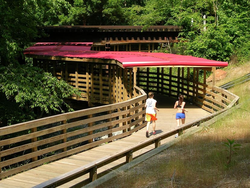
The Cape Fear River Trail is a paved, ten-foot-wide shared route extending more than seven miles one way between Jordan Soccer Complex and the Cross Creek trail connection, with river views, bridges, wetland boardwalks, wildlife signs, and mountain-bike access.
At this place
Upcoming events
Inside this place
Explore the grounds
Choose a destination, preview what it looks like, then open Explorer for live on-site guidance.
Public record
Verified information
What people ask
Useful answers about this place
Frequently requested details, researched and kept current by AuditMap.
What address or entrance should I use for Cape Fear River Trail?
For central access use Clark Park near 511-631 Sherman Drive, Fayetteville, NC 28301. Jordan Soccer Complex and Riverside Dog Park provide other access points with different parking capacity.
Where should I park for Cape Fear River Trail?
Primary parking is available at Jordan Soccer Complex and Clark Park; Riverside Dog Park has limited parking. The trail is not a loop, so long one-way trips require a return plan or pickup.
When is Cape Fear River Trail open?
The trail is open 365 days a year from 8 a.m. to dusk. Connected parks, restrooms, dog park, soccer complex, and construction areas may use different schedules.
Is Cape Fear River Trail free?
General trail access is free. Programs, events, rentals, and nearby facilities may charge separately.
Are there restrooms at Cape Fear River Trail?
Restrooms are available at developed park and trailhead locations such as Clark Park, but not continuously across the route. Plan stops before a long trip.
What accessibility information should I know about Cape Fear River Trail?
The main trail is ten feet wide and paved with long boardwalk and bridge sections, but some hills are steep and approaches, temporary detours, and connecting paths vary.
What are the paths or trails like at Cape Fear River Trail?
The route is more than seven miles one way, with flat and hilly pavement, wooden bridges, a covered bridge, and over 1,000 feet of wetland boardwalk. Cyclists must stay under 15 mph and yield to pedestrians.
What can families do at Cape Fear River Trail?
Choose a short out-and-back from Clark Park or another developed trailhead rather than attempting the full one-way distance without transportation. Bring water and supervise at slopes and road connections.
Can I bring a dog to Cape Fear River Trail?
Leashed pets are allowed and owners must remove waste. Keep leashes short around bicycles, runners, boardwalks, wildlife, and narrow or steep sections.
Can I picnic at Cape Fear River Trail?
Use picnic facilities at Clark Park or another connected park rather than stopping across the shared travel lane. Organized trail events require approval.
What landmarks or areas should I look for at Cape Fear River Trail?
Highlights include Clark Park and the Moses Mathis trailhead, river overlooks, covered bridge, wetland boardwalks, Jordan Soccer Complex, mountain-bike access, Riverside Dog Park connector, and East Coast Greenway designation.
What closures or conditions can affect Cape Fear River Trail?
Flooding, storm debris, bridge or boardwalk work, river conditions, and construction can interrupt sections. Check City notices before relying on a continuous seven-mile trip.
Quick community check
Help verify this place
Know this place? Check one detail from a recent visit.
✓ Accurate × Incorrect ? Unsure
Community for this place
What people are noticing
Ask a question, share what changed, or help make a detail more reliable.
The place logUseful questions, updates, and confirmations from this community.
Keep exploring
Nearby public places
Based on this place's location and public details, not your activity.